It may have been let, sold or temporarily removed from the market by the agent.
This property is no longer available.
Location
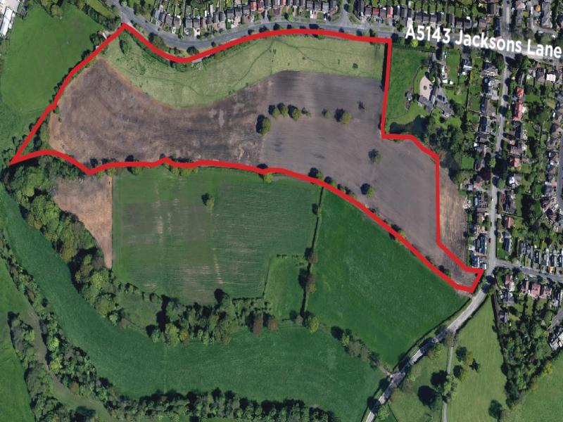
The site occupies a prime position fronting Jacksons Lane in Hazel Grove approximately 100 metres to the east of its junction with Chester Road, approximately 1 mile from Hazel Grove town centre and 2.5 miles from the highly sought after location of Bramhall town centre.
It is situated within a semi-rural residential location within the heart of the Cheshire commuter zone.
It is within 5 miles of the M60 and M56 Motorways and has easy access to the national rail networks and is close to Manchester Airport.
The site is located within Stockport Metropolitan Borough Council (SMBC) although it should be noted that the Cheshire East Council boundary is located directly to the south of the site.
The immediate vicinity provides a mixture of semi-detached and detached private housing, Hazel Grove High School is within 500 yards of the land which links directly to the Hazel Grove Leisure Centre.
Description
A copy of the Title Plans accompanying the particulars shows the approximate boundaries of the site edged in red.
The land is currently in farming use.
The land has frontage to and access from Jacksons Lane.
Planning
The site has no recent planning history and is located within green belt adjacent to Hazel Grove settlement boundary as defined by Stockport MBC.
Due to the sites edge of settlement position we believe it could hold potential for residential development, subject to achieving planning permission.
The land has been the subject of a submission to the Greater Manchester Spatial Framework 'call for sites' in January 2016.
Any planning related enquiries should be directed to Stockport Metropolitan Borough Council, who are the local planning authority.
Land
The total size area is approximately 21 acres.